Sunday, 13 October 2019

Gordes, Vaucluse, France, October 2019 - Tourist growth and change

I have just been in the village of Gordes, in Provence, for the fourth time.  My first visit was in 2007, so I have seen it over a number of years.  Gordes is one of the places that almost all guidebooks provide strong encouragement to visit, but in truth there isn't a great deal to do in the village itself - the main attraction is really the site itself, particularly if one is driving in along the main road from the valley below.


There is more to occupy one's time in nearby Roussillon, where the ochre quarries are of considerable interest.  The Abbey of Sénanque, which must be one of the most familiar images of Provence from calendars, all pictures being taken during the few days when the lavender in front of the abbey is at its best, is a couple of kilometres away (and actually lies within the commune of Gordes although not the village itself).  There is an ancient village of circular stone-built huts in the opposite direction.  Gordes has a small castle, and a number of viewpoints over the valley below, but not a great deal more - apart from restaurants and bars.

Nevertheless, I have been back four times in the last few years, and I certainly find it an atmospheric and attractive location.  But something I have noticed, particularly on my most recent visit, has been that Gordes is changing - and doing so quite rapidly.

Where in 2007, when I first came, one could get an evening meal in the hotels or in two other restaurants at opposite ends of the quality scale, today, in 2019, there are upwards of 10 restaurants operating, and even in late September and early October booking is essential for a table for dinner - and prices are substantial.  The two original places - l'Artégal and l'Estaminet - have been joined by the Bastide de Pierres (owned by the biggest hotel a little down the road), La Trinquette, the Crêperie de Fanny, Le Jardin, the Restaurant l'Outsider and more.  The friendly (and cheap)  boulangerie  near the church is still open from the crack of dawn onwards, but another on the other side of the square has closed.  Some of the bars have become either restaurants or fast food places.  The Cercle Républicain remains a traditional bar welcoming all comers, local and visitors alike, for 365 days a year but makes few concessions to visitors - its plate of croissants and pains chocolats is quickly depleted in the morning and not afterwards recharged. I hope the Cercle can last as it is.

Breakfast in the Cercle Républicain

On this visit I missed the extensive Provençal market held on a Tuesday on both sides of the castle, but I suspect little will have changed at that, other than more stalls aimed at tourists (selling Marseille soap, Provençal herbs, lavender bags and so on) than in the past.

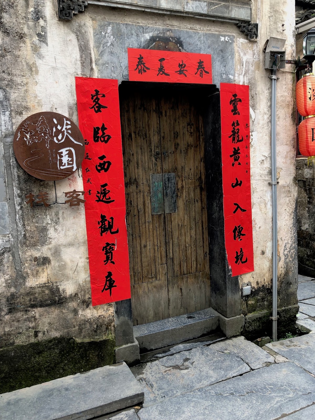
But at all times of the day Gordes is thronged with visitors - among them many from Asia or from Eastern Europe - who are asked to park outside the village and walk in.  Those who don't stay to eat or drink will, I expect, stay an hour but not much longer. They will visit the souvenir shops (where a high proportion of the merchandise on sale, pleasingly, is from the local region).  But they will stay in the top part of the village rather than descending the cobbled paths to the valley bottom where some of the oldest and most interesting properties lie.  One afternoon I spent an hour sketching down there and during that time only two couples passed me, whilst the square up above was busy with visitors.

Gordes is typical of many tourist villages in France, and more widely across Europe - a stop on a day's touring by car, a 'must see' in the guidebook, a few photographs, a coffee or soft drink, possibly a small purchase, and then on to the next place.  But I have watched the main road into the village in the evening, the one that comes past the viewpoint, and seen that it is almost devoid of traffic.  The rhythm of visits lasts from around 10 until 6.  So do the new restaurants make enough of a living from lunch visitors alone?  But as I've already commented, a booking is needed for dinner.  Where do the diners come from?  And what is happening to the village and its inhabitants more generally?

I have been delving into the available statistics from the French national statistical office, and they make very interesting reading (and, again, are, I suspect, typical of many other places).

There are actually only 164 hotel rooms in Gordes, 45% of them in 5 star establishments and with nothing below 2 star.  This is high class (and expensive) hotel tourism.  The 'best' hotel has recently joined the 'Grand Luxury Hotels of the World' marketing group: after a recent refurbishment it now dresses its staff in mock eighteenth century outfits, presumably aimed at impressing an American clientele.  There is only one camp site (at 3 star), with 100 pitches.  But added to these are 615 bed spaces in rented properties, air bnb, bed-and-breakfast offerings and so on.  Most of these are in the rural areas surrounding the village, and many of them are extensively advertised through English- or Dutch- language web sites.  They are, in the main, up-market properties with a range of amenities including, sometimes, pools, and they are almost all stone-built providing the fantasy, for urban residents from elsewhere in France or Europe more generally, of living for a week or so in an authentic rural setting.  

People have been visiting Gordes for decades, since those parts that were destroyed by Nazi bombardment during the war were rebuilt - among those who came were Marc Chagall and François Mitterrand.  But some who come decide to stay, or at least to purchase a stake in the village.  (There are more estate agents now than there were in 2007.)  In 2011 just over 40% of properties in Gordes were second homes; by 2016 that had risen to 46%.  During the same period the resident population had fallen, by 9%, from 2056 to 1873.  The scope for further growth in second homes is considerable - in 2016 there were over 150 vacant properties in Gordes, although most would require significant investment to make them habitable for prosperous buyers expecting certain standards of accommodation.

And what about the residents of today's Gordes?  They are elderly.  In 2011 41% were over 60: by 2016 that had risen to 49.4%.  By now (2019) over half the population must be in that age category.  And the education level of residents is high - over one third have a degree level or professional qualification.  It seems as if the retirees are of high status.
 Second homes in the lower part of the village

Gordes is undergoing a dual process of growth in the tourist industry, and of a move upmarket in terms of who is attracted to it and the surrounding area.  But tourism is growing not through new hotel capacity - instead it is day visits and self-catering activity that lead development.  What use are day visits to tourist villages?  They create traffic congestion and the amount spent by visitors may be low.  Self-catering may provide an income for landlords, but I have the suspicion that many of these are not local residents and may even be property companies based abroad.  But their tenants do create a demand for restaurants - even if they drive to a supermarket on the edge of a nearby town such as Apt or Cavaillon for their shopping.  The permanent residents are ageing, and the hotels increasingly depend on migrant staff.  The employee that came to check my room one evening was from Moldova and spoke virtually no French or English - and my Romanian runs only to buna seara (good evening) and multumesc (thank you).

Gordes is still very well worth a visit.  But what is going on under the surface of tourist villages such as this poses interesting questions about what the future will hold.   

Sunday, 2 June 2019

Alberobello, Puglia (Apulia), Italy, June 2019 - Making the most of historic poverty

It is five years since I was last in Puglia, and the intervening period has witnessed significant change. Puglia now seems to be high on the list of 'must-visit' places for tourists from many parts of the world.  In the UK we see numerous holiday advertisements for tour groups that will take in Alberobello, Otranto, Vieste and Matera as part of a coach excursion.  (Matera is actually in Basilicata rather than Puglia and has risen to fame this year as one of the European Capitals of Culture - more of that below).  Over the last few days I have heard groups speaking English, German, Dutch, French, Spanish, and Chinese, as well as Eastern European languages that I can't decipher.  When I was last here there were certainly English and German tourists around, but the whole world now seems to come to Puglia.

Looking back to the days when I studied the geography of Italy as part of my degree, this transformation in the image of the region seems astonishing.  This was one of the poorest parts of Italy at the time when the great investment bank for the south - the Cassa per il Mezzogiorno - was set up in 1950.  That investment didn't actually do much of substance other than improve the roads, because a lot of money went into capital-intensive developments such as steel works and oil refineries that did little to alleviate local rural unemployment and poverty.  Just over the border of Basilicata the writer and intellectual Carlo Levi had been outlawed to the desperately poor and backward village of Aliano by the Mussolini regime in the 1930s, resulting in his wonderful book 'Christ stopped at Eboli' in which he argued that these southern parts of Italy had never been visited by anybody except as an enemy or an outsider seeking to extract what little value they could from the region.  Many years ago I was impressed by the Goncourt-Prize-winning novel 'La Loi' ('The Law') by Roger Vailland (1957) describing the scarcely functioning rural society of a part of Puglia near Bari.  And in 1983 Francesco Rosi set his Oscar-nominated film 'I Tre Fratelli' ('The Three Brothers') in the same area.  Characteristically, the three brothers had all left for careers elsewhere, in Rome, Naples and Turin,  returning home only on the death of their mother but then leaving once again. Emigration was the way out of poverty in the region.

I have been staying in exactly the area where these images most strongly applied - the Murge.  It is a  plateau  around 1000 feet high, made up of karst limestone and with a steep drop to the coastal plain to the north-east.  The soil is a distinctive red-brown colour, field boundaries are dry stone walls, and the dominant crop is olives.  Luckily, in this area the disease that is decimating Puglia's olives further north - xylella fastidiosa - has not (yet) developed.  If and when it does it will transform the landscape into a wilderness.  But at the moment, with the exception of the olives, parts of the countryside look remarkably English.

So what has brought about the transformation from the impoverished image of the past to the tourist presences of today?  My last blog was about two UNESCO-listed villages in China, and here once again UNESCO is in part the cause.  Parts of the town of Alberobello are listed, just like the villages of HongSun and XiDi in Anhui, China.  And the general area around is under a number of protective measures.  The reason is the local vernacular house-type - stone-built single-storey buildings with conical roofs also made of stone, with most houses made up of several interlocking circular rooms.
'Trullo' houses

The town containing the greatest number of these 'trulli' houses is Alberobello where whole districts are comprised of this distinctive architecture.  The history of this local house-type is unclear - there appear to be few references to it before the seventeenth century (but then no writer was interested in such an impoverished area before then).  They may date back earlier (on some houses there are plaques claiming a history back to around 1400, but proof is slight).  What is certain is that these were the dwellings of the poor.  
Part of Alberobello

So the historic poverty of many parts of Puglia has now become a factor in the attraction of tourists to the region.  The trulli with their lack of running water, animals and people sharing one property, and poor living conditions (children often slept on wooden platforms under the conical roofs, accessed by wooden ladder) have become tourist attractions.  Most in Alberobello itself are now either souvenir shops or have been upgraded to become Air bnb properties, whilst many of those out in isolated spots in the countryside have been spruced up with the addition of swimming pools to be let as holiday villas.
Trullo converted into a holiday villa

But doing up a trullo  is now an expensive business.  Planning and conservation laws, even outside the UNESCO zone, mean that the cost of repairing a roof has risen ten fold in the last few years, and detailed regulations have to be followed in any renovation scheme.  (Or should I say, there are detailed regulations in existence - although I suspect they are often got round in some way, such is the custom in Italy.)  There are many hundreds, possibly even thousands, of trulli in the area between Alberobello, Locorotondo and Martina Franca that have collapsed or are in total disrepair - a sign of the way in which, during the post-war period, their inhabitants moved out of them as soon as they could.  Many of the older residents of the area must be amazed by the way in which the properties that they fled from out in the olive groves have become the preserve of wealthy northern Europeans, either as holiday homes or holiday rentals, once many thousands of euros have been spent on them (including, of course, the digging out of swimming pools and the removal of huge limestone boulders that lie beneath the thin soil of the area).

I don't see this as voyeuristic tourism because the holidaymakers are not here to see or experience poverty.  Something a little different is perhaps present in Matera, referred to earlier, where the big tourist draw is to see the 'sassi', the houses carved out of rock faces (effectively caves) where people lived until they were (often forcibly) relocated to social housing in other parts of the city from the 1950s onwards.  I visited Matera in 2014, and there was a frisson in seeing the amazing conditions in which whole families once lived.  But the area of the sassi has now become chic and hotels have since been created in the old caves. It still baffles me, however, as to why the city was chosen (along with Plovdiv in Bulgaria) as one of the two European Cities of Culture for 2019.

Tourist developments in inland Puglia and Basilicata have probably created more employment than the Cassa per il Mezzogiorno ever did, and spread across a wider area (at least in the trulli zone of the Murge plateau). But there is another way in which the past poverty of the region has become a selling point - through its cuisine.  I notice, though, that what was advertised in 2014 as cucina povera ('the cooking of poverty') has now been reimagined as 'authentic Puglia products' - but the ingredients are the same: the use of rough wholemeal flour, brown pasta, dried beans, biscuits (taralli) made with a little white wine and olive oil.  Today's food fashions make such simple products sellable.  Last night in a restaurant I ate lampascioni  - grape hyacinth bulbs treated with oil and vinegar and tasting a little like shallots.  Puglian cooking, traditionally some of the most basic in Italy, is now all the rage.  I'm not always impressed with it.  Five years ago, at a time when it was still being sold as 'cucina povera', I chose the menu bearing that name in a side street restaurant in Lecce (a city that has always bucked the trend of regional poverty, with some of the most stunning baroque churches one could find anywhere in Europe): it was one of the most boring meals I have ever had to pay for.

So the economy of Puglia has traded on its history of poverty and is now creating new images for the region and attracting new activities to its inland areas to supplement the coastal tourism that has been present for many decades (principally driven by the demands of Italian families).  Data for 2017 show that gross domestic product per capita in Puglia is now ahead of that in Campania (around Naples), Sicily, and Calabria - although it is still at only 65% of the average for Italy as a whole.  There is some way to go, but Puglia is doing better than much of the rest of the Italian South.

My previous blog was also about UNESCO-recognised villages - but in China.  Both in Italy and in China I saw distinctive house types - as well as witnessing a history of poverty.  But there is also one great similarity between the various villages I have visited.  Sitting in a pizzeria near the start of the main street in Alberobello, three groups with 30 or so people in each make their way past me, each group led by a guide holding a flag on a stick; they are clearly making the ten minute trek up from the coach park on the edge of the village.  In HongSun I waited several minutes to cross the bridge over the South Lake into the village while a number of tour groups, each led by a person carrying a flag on a stick, hustled past me: I didn't see their tour buses but they must have been somewhere near.  Recognition brings tourism, and tourism so often means groups.  What do such groups get out of visiting historic villages?  There were large numbers of school parties in Alberobello, just as in HongSun and XiDi, each group distinguished by a common cap colour or some other uniform.  Most children were more keen on talking to their friends or, for older children, taking selfies and group photos than in listening to their teacher or guides explain what they might see.  What do school parties actually learn from a visit to a historic site?  Souvenir shopping was also a dominant activity in all cases: at least that would have an economic benefit.  But mass group tourism brings its own problems.  Could Alberobello ultimately become a less attractive destination because it is too crowded with groups?  In China, might visitors to HongSun turn instead to LuSun?  If I come back to Puglia again in five years time what further changes will I see?


Monday, 20 May 2019

Anhui villages, China, April 2019 – A glimpse of rural life and history


I first visited China in 2007 but until now heavenly seen the life of some of the big cities - Beijing, Hangzhou, Nanjing, Shanghai and so on.  I have just returned from a few days spent in and around some of the villages of Anhui province, which remains economically backward compared to the other provinces of the coastal south-eastern region of China (despite the fact that it is only three hours by high-speed train from Shanghai).  Over three days I have been in Lucun, HongCun, GuanLu, NanPing, PingShan, and XiDi villages, all of them probably over 1000 years old.  Two of them, HongCun and XiDi, are UNESCO World Heritage sites and very much on the tourist map.  But the others, although certainly visited by a few outsiders, are much quieter and still dominated by the traditional activities of the residents.

So what have I learned through these visits? Apart from the obvious contrasts with Shanghai, where I was based on this particular visit to China, I reflect that spending time in these villages has demonstrated something about both the tangible and the intangible legacies of China's history and the ways that both are present in the contemporary rural scene.


Interior courtyard in wood - Lucun


         Inside Lucun village - stone-built properties

The two most immediately obvious tangible elements of the villages are, firstly, the fact that the houses are constructed of stone with no windows at ground level – all the light coming via courtyards hidden behind the high and fortress-like walls of the properties. And the second element is that the interiors of the properties make considerable use of intricately-carved wood from the local hills. The solidity of the exteriors is therefore dramatically contrasted with the intimacy of the detailing inside the houses.


These are elements of a local architectural style, reflecting wider aspects of local culture in the district known as Huizhou (and extending as far as language – at one point when two local young people were talking together my colleague from Shanghai turned to me and said “I can’t understand a word they are saying”.)  The roof beams of the houses are finished off in a flamboyant gesture locally known as a ‘horse’s tail’. 
                                               
Alleyway, NanPing

Water supply was clearly crucial in the establishment of these villages, and each has streams running through, or close by, or has created artificial ponds to supply the needs of the residents.  In HongCun (one of the UNESCO sites) the village is centred around the ‘Moon Pond’, reputedly planned by the wife of the village leader during the later Ming period in the early seventeenth century, with a second lake providing a possible defensive barrier immediately to the south of the village.

Moon Pond, HongCun

  South Lake, Hongcun

 Lake and gateway to the village, XiDi


LuCun village surrounded by fields of oil-seed rape

To a European, there is one tangible element of village-scape that is missing.  Whilst the church (or churches) dominate(s) the external view of almost all European village centres, such a focal point is missing in the Chinese case.  Viewed from afar, these villages all appear low-slung and relatively formless (although certain of them have central squares of some kind).

There are many other noteworthy features of these villages, but they are too many for a blog such as this. One element worthy of comment, however, is the narrowness of the lanes within the villages – generally too narrow for even a cart and thus producing a dense and intimate feel to the settlement suggesting that all space is seen as privatised in some way.

But the intangible elements from these villages are as important as their physical characteristics.  The UNESCO listing of HongCun and XiDi is doubtless part of the reason for the presence of large numbers of school parties and organised tours, but these are also there not just to look but also to learn about the ways of rural life in an era of extended families and clans, of Confucianism (and Taoist influences), of earlier village educational expectations, and respect for ancestors: in short to learn about traditional ways of social organisation, expected behaviours and ‘living the good life’.  Past norms of behaviour are constantly being referenced by the guides in these villages, and by the artefacts and furnishings to be found in the buildings – many of which are open to the general public who are encouraged and licensed to enter private houses to explore their features while the residents quietly sit and watch the visitors. 

Alleyway in NanPing


                                                                   Alleyway in HongCun

Several of the villages remain dominated by the extended clan of an individual family.  In GuanLu, for example, a much-visited feature consists of the eight interlinked houses built by brothers of a merchant family – the Wangs – during the early Qing period (late seventeenth century): the Wang family can actually be traced back to the Song dynasty (around the first millennium) and is still dominant in the village today.  Most residents of NanPing are members of the Ye family who built ancestral halls here in the Ming period (1368-1644): in these clan power over family is exercised by elders in the presence of the spirits of their ancestors. Some of the finest of these family ‘temples’ were used by Ang Lee as the setting for scenes in his Oscar-winning film Crouching Tiger, Hidden Dragon (which also took location shots in HongCun).  XiDi is still dominated by the Hu family (from a branch of which President Hu Jingtao, with ancestors in Anhui province, came).  LuCun takes its name from the Lu family who still make up the majority of its inhabitants (Cun means ‘village’ and is pronounced with a soft 'c', like an 's').  

The interlocking houses of the eight brothers in GuanLu

Ancestors hall of the Ye family, NanPing

Particular spaces within the buildings were reserved for particular groups – for instance for women, for male elders, for servants, or for children’s education. Schoolrooms existed for whole families. Places of honour were located either side of the table in the principal room.  And on that table a particular arrangement of a mirror and water jar with a Buddha (or more recently a clock) in the centre was deemed to bring good luck. I was instructed on these matters in a house in LuCun originally built by the merchant Lu Bangxie but more recently refurbished by a member of the Wang family from nearby HongCun.  And in several buildings the importance of feng shui in the design of spaces was emphasised.

The inner place of honour in Lu Bangxie’s mansion in LuCun

The retired village schoolmaster and the author of this blog in the seats of honour in a HongCun house


Tourist visitors pretending to attend the old village school, HongCun

And everywhere within the houses and in the public spaces there are black and white paintings as well as a plethora of texts and writings – poetry, sayings from the old writers, rules dating from pre-Communist times admonishing residents in how to be virtuous, door surrounds in red to bring good luck.

Posters around the door of a tea house and Airbnb in XiDi

But to end this long blog, with its many images, I will turn back to the overall meaning of a visit to villages like these.  To the urban population of today’s China such a visit tells of a past way of life, of traditional historic patterns of existence, of continuity, of value systems that date back millennia, of the meaning of family in a world where the domestic unit, in an era after the one-child-policy, has shrunk significantly from the sizes that once dominated in these country places.   A trip from contemporary Shanghai to these Anhui villages also demonstrates something about inequalities in contemporary China. Residents in old houses here sit under the eaves of their courtyards, receiving a bare income for allowing visitors to enter, while the rain drizzles down into the open space in front of them with no sheltering wall separating them from the elements.  I see people washing their pots and pans in the stream. Chickens run in and out of houses. Turning a corner in one village we come across an old woman almost bent double with age, putting fodder out for a cow and calf tethered in a corner of an alleyway.  These are some of the realities of rural China, inequalities that President Xi has vowed to combat.

This doesn’t necessarily mean sweeping away the old.  The past can be remodelled for present and future use.  HongCun and XiDi villages have become tourist meccas, with much of what that entails all round the world in terms of souvenirs, local (and some non-local) crafts, and eating opportunities.  I spent some time with a research student from HongCun who is intent on creating sustainable and planned tourist growth for her village.   I was impressed by the local entrepreneur who has invested vast amounts of time and money in restoring the Lu Bangxie mansion in LuCun.  But one of my lasting memories will be of the hotel bar in PingShan where four of us sat drinking Swiss-style hot chocolate and eating Belgian waffles in a long discussion about conservation policies in China and the UK – a bar and hotel in a building re-assembled from the wall of a derelict ancestral hall and the addition of a reconstructed family temple in wood, brought together by a film director, Zhang Zhenyan.  Here lay a homage to the cultural past of the region sensitively adapted to create a facility for rural employment and revival for the future.  I would like to go back in a few years to see how it’s doing.
Interior of the hotel bar in PingShan


Monday, 18 March 2019

Madeira, Portugal, March 2019 - Virgin land, settlement and slavery

I have just returned from a first visit to the island of Madeira.  Politically it is a constituent part of Portugal but geologically, as I was told by Ronaldo, the driver  I hired (not to be confused with his more famous namesake, the footballer, who also comes from the island) it is part of Africa.  In various places I saw signs marking the 600th anniversary of the discovery of the island in 1418 by two Portuguese mariners, João Gonçalves Zarco and Tristão Vex Teixeira.  (The first landing happened the following year.)  Dates of ‘discovery’ can, of course, be disputed, and it now seems likely that Vikings visited the island (and its small surrounding archipelago), and it is possible that Pliny knew of it even earlier.

It dawned on me after a few days that there was something very distinctive about the history of Madeira. This was the very first place I had visited anywhere in the world where there had been no inhabitants prior to the arrival of European settlers – which happened within a year or two of Zarco and Teixeira’s report back to Henry the Navigator in Lisbon.  Madeira was genuinely a terra nullius – or unoccupied land, unlike other parts of the world (particularly Australia) where that epithet was inaccurately accorded in order to eliminate any native people’s claims.

I have visited every continent except Antarctica, and everywhere I have learned of histories of contact between Europeans and already-resident populations.  I have been to certain West Indian islands (for example St Lucia and Barbados in the Lesser Antilles) where European settlement was preceded by Caribs and Arawaks.  The Smithsonian Institution has an ongoing project showing how there are continuing legacies of these people in the islands today.

There were Algonquin peoples in what is now New York a thousand years before the Dutch settled the site, and the curious line of Broadway, cutting across the grid pattern of streets of today’s Manhattan, is a legacy of the native hunters’ Wickquasgeck  Trail. (The name ‘Manhattan’ is itself of native American origin).  In San Francisco I have heard about how thousands of native Americans were killed in an apparent policy of genocide or ethnic cleansing in the mid nineteenth century to make way for the new settlers of the state of California.  Throughout Canada I have been impressed by the way in which the ‘first nations’ of that country are now celebrated and their history commemorated, providing some form of atonement for previous persecution of these groups.

In Australia I have participated in conferences where, at the start of proceedings, there is formal recognition of the so-called ‘aboriginal’ group from whom the land for the conference building was taken.  And in New Zealand I have seen, and commented on in earlier blogs, the ways in which the whites (pakeha) and Maori came into contact, generally to the disadvantage of the latter. And no one with the slightest knowledge of South Africa can be in ignorance about the issues of contact between European settlers and original populations.

These examples are all drawn from places I have visited outside Europe.  (I might add that within Europe I have also heard of the effects of contact for the Sami peoples of northern Scandinavia, told to me while sitting in the house of a Sami man in northern Finnmark.)  I am excepting China and Japan here, both of which I have also spent time in: in both of those cases European travellers were faced with societies of similar levels of development as themselves. 

In every one of the other cases the arrival of Europeans brought upheaval, disease, the expropriation of land (or the disavowal of the rights of earlier peoples to use it), and sometimes genocide.  The role of Christian churches and their insistence on a ‘civilising’ mission of conversion was particularly profound, dismantling existing societies and belief patterns and often prohibiting practices that had tied peoples to their land for generations.  Through almost every other country I have visited there have been long-term effects that have hugely damaged not just the ways of life of ‘first nations’ peoples (to use the Canadian term, which I rather like) but in most cases have also drastically reduced the viability of their societies and decimated their numbers. (Again, I except Japan and China from this generalisation, although contact in 19thcentury China and the Opium Wars were not exactly beneficial episodes in China’s history).

So was Madeira a paradise where European settlers found virgin territory and were able to establish an economy and a society without destroying something that pre-existed it?

Ronaldo, the driver, took us on a tour of the Eastern part of the island.  And for an hour or so we walked alongside one of the levadas or irrigation channels (from the Portuguese ‘levar’ – to carry) that run along the contours of the mountains to bring fresh water from the heights, particularly in the north, down to the fields below and to the lower-lying towns. There are no underground water sources on volcanic Madeira, so the use of surface water was essential.  There are between 1400 and 2000 km of levadas in total, although some are in disrepair. They are one of the great joys of Madeira, providing easy walking with stupendous views surrounded by plentiful wild flowers.  We were accompanied on our walk by local Madeiran chaffinches.  

 
A levada walk

A Madeiran chaffinch

Most written and web materials on Madeira and the levadas use the passive tense in describing their construction: ‘they were built’, ‘they were constructed’, ‘a network of levadas was created’ and so on.  But by whom?  Some sources are more explicit – they were built by Arab and African slaves who were brought to the island in the later fifteenth century to work on the sugar plantations set up by the Portuguese and to construct the all-important water channels that supplied the irrigation water.  Constructing the levadas along the precipitous mountainsides was dangerous work, and slaves were suspended from above to cut the channels with hand-tools.  The first slaves on the island were recorded in 1452, from both North Africa and from the Canary Islands (the Guanches – indigenous peoples: unlike Madeira, the Canaries were already inhabited by non-Europeans).  In 1614 the population of Madeira was enumerated as just over 28,000, of whom 3,000 (11%) were slaves.  But the sugar plantation economy collapsed later that century in the face of Caribbean competition.  And Portugal abolished slavery in 1775.

So although Madeira is unique in my travels as a territory where the first European settlers faced no indigenous populations whatsoever, subsequent history reflects so many patterns elsewhere – of the exploitation of an ethnically and culturally different population – in this case through the operation of the slave trade.   The South African media company IOL describes Madeira as ‘The Portuguese island with slave roots’.  And it is true that some of the most distinctive tourist attractions of the island – and therefore the basis of one of the three pillars of the island’s contemporary economy of tourism, Madeira wine, and bananas – are the product of slave labour.

Every place has its elements of uniqueness, but beneath these there are always general patterns of historical, sociological and economic evolution that respond to wider forces.  Despite its unique origins in terms of European settlement Madeira shares its history of the exploitation of ‘non-European’ populations with other European powers’ colonies around the world.


Friday, 9 November 2018

Kirkenes, Finnmark, Norway, November 2018 - The Norwegian far north

In customary understanding about the Second World War, at least in Britain, the northernmost part of Scandinavia does not feature much, if at all.  In my own family history we do have some recognition of it – an uncle of mine served on the merchant navy vessels making up the convoys supplying the Soviet forces via Murmansk and Arkhangelsk and was, I believe, torpedoed and rescued from the sea.  Those convoys had some of the highest mortality rates for any personnel involved in the war anywhere.

I have just been in Kirkenes, one of the most north-easterly towns of Norway.  Kirkenes suffered the second worst bombardment of any place in Europe, after Malta.  By the end of the war only 13 houses were left intact.  And around Kirkenes, in all the other towns of Finnmark, there were similar levels of destruction – through the initial Nazi occupation in 1941, through shelling and bombing as those occupying forces defended themselves against Allied attacks (from both the Western and the Soviet allies), and as a result of the scorched earth policy whereby as the Nazi occupiers retreated they destroyed all property in sight.  Earlier the sea inlets of this area had been crucial to the Nazis as hiding places for their naval vessels tasked with attacking the Allied convoys – they had sheltered the Tirpitz and the Scharnhorst battleships, for example.  And airfields had been of similar use to the Luftwaffe.  The details of the Lapland War and the Petsamo-Kirkenes Offensive which drove the Nazi forces out of northern Finland and northern Norway are complex, but the liberation of Kirkenes by Soviet forces finally took place in October 1944 after three years of what must have been a local hell.  This morning I visited the Soviet War memorial, in a residential neighbourhood of the town, and found it festooned with large wreaths, presumably placed there on the anniversary last month.

The Soviet War Memorial

But Kirkenes seems to me a fascinating place for more reasons than its wartime history.  I have visited as part of a Hurtigruten coastal voyage – on board the daily ferry that travels up from Bergen and back calling at innumerable small ports on the way.  I talked to a French fellow passenger in the town centre who commented on the ‘atmosphère spéciale’ of the town, and I agree with him.

It has been an overcast morning with solid ice on all of the pavements and on most of the side roads, but grit had been spread on many surfaces to improve walkers’ and vehicles’ grip.  I met an older woman pushing what appeared to be a zimmer frame, with attached basket, in front of her but as she passed I realised that it was actually mounted on skis.  Every occupied house had lights shining in every window, so that whole residential areas twinkled brightly in the gloom of an early November day.   The annual 50 or so days with no sun will start later in the month.   

Norwegian-registered cars slowed to a crawl as they passed pedestrians making their way along the edge of the main road, but some cars carried on at their normal speed and I quickly noticed that these were Russian vehicles that have come through the only land border between Norway and Russia which lies only 15 kilometres or so away to the east.   It is curious to reflect that although Kirkenes was liberated by Soviet forces in 1944, throughout the Cold War it stood as a front-line town where NATO (of which Norway was a founding member) confronted the USSR: if at any time Soviet forces had wished to invade a NATO power the quickest way to have symbolically done so would have been through Kirkenes.  Today, in the post-Cold War era, 10 per cent of the town’s population are Russians.

I went into a busy café where Elvis Presley's In The Ghetto was playing on the radio.  The young woman serving was happy to talk.  She was born in Kirkenes and had never lived anywhere else – and nor did she want to.   Many young adults who move away come back, she said.   Despite the proximity of Russia – and the fact that local Norwegian identity card holders can cross the border without securing a visa first – she had never done so.  A week or two ago I was in Oslo and when the receptionist in my hotel there heard I was going to Kirkenes he sighed and said how much he’d like to go back, having worked there for a year.

So why does Kirkenes have such a special draw, and a distinctive atmosphere?  In part it’s because it’s the last stop in democratic, liberal and modern Norway.  But there are a number of other North Norwegian towns that can similarly claim to be at the end of the road – Hammerfest claims to be the most northerly town in Europe, although vying for that distinction with Honningsvåg (much depends on the definition of a town), Vardø is the most easterly town in Norway: I have visited all these places on my trip.

But to its geographical distinction Kirkenes adds the special Norwegian flavour of a thriving and supported settlement, despite its small size and its isolation.  Serving a town population of around 4,000, and a wider local area of at most 10,000 souls, are a modern public library, sports pitches and indoor gymnasia and a sports centre, a swimming pool, schools for all levels, a hospital, a theatre and cinema.  As I explored the town, public buses were strongly in evidence, traversing small back roads amongst the wooden-framed houses, all of them rebuilt since the destruction of the town during the war.   The population remaining by 1946 had been largely evacuated to Harstad, much further south in the Vesterålen Islands, for two years while their town was rebuilt: ironically they were housed there in a former Nazi prisoner-of-war camp for Soviet captives.  


Housing in Kirkenes

I was amazed not just at the number of shops but also at their quality – clothes shops that would grace any middle-class high street, shoe shops with a massive range of merchandise (although majoring on boots at this time of the year), a bookshop and stationers, two indoor shopping malls, motor dealers (with snowmobiles as their principal offering at the moment).  There seemed to be more wool on sale than in most places (a possible occupation through the winter months?), and as throughout Northern Norwegian towns there seemed an over-provision of hairdressers that I find difficult to explain. The range of retailing (market driven) and of public facilities in Kirkenes puts to shame what is available in many other places five times its size in other parts of Europe.  So, why is the town (and others like it in the area) so vibrant?

High class shopping

Since 1990 the Norwegian county of Finnmark has been given special tax status with lower rates for residents – such that a four person household might benefit to the tune of 100,000 krone per year (or about 9,000 UK pounds) over residents of other parts of the country.  That clearly helps household expenditure levels, and from the estate agencies windows (most housed within savings banks) I looked at in Kirkenes, housing costs are not particularly high.  But on the public sector side, Norway takes both an egalitarian and a social democratic view – that it is the state’s responsibility to ensure that inequalities within the country are reduced, including inequalities between regions, and that the provision of many basic services should be determined by the state and not by the market.  Two Americans on the boat were arguing with one of the crew last night when they heard about this – accusing Norway in no uncertain terms of being ‘socialist’ or even, in one heated moment, ‘Marxist’.  But this has been the Scandinavian way ever since the Second World War.  The aim to reduce disparities, and to do so through government intervention, is at the heart of much Scandinavian political ideology.  And it is worth pointing out that Norway is one of the richest countries in Europe – 3rdafter Luxembourg and Switzerland in GDP per capita in 2017.  OECD data for the same year show that Norway, along with Iceland, Denmark, Sweden and Finland all have much lower levels of income inequality than countries with lower levels of public expenditure such as Germany, the UK or the USA – or than the other two wealthiest European states, Luxembourg and Switzerland.

Norway has made very sensible use of its oil and gas income (which amount in the average year to around one-sixth of the economy) by creating a sovereign wealth fund.  And this enables that egalitarian ideology to extend to accessibility – in a country made up of mountains, high plateaux, and innumerable inhabited islands.  Amazing numbers of bridges, and even undersea tunnels, have been created in recent years to link even small settlements into the national communications system.  I have seen major new bridges reaching out to islands with only 200 people.

So the atmosphere of Kirkenes is inflected by a number of influences, both geographical (its position near the Russian border) and through Norwegian public policies.  Even isolated towns in the far north can offer a high standard of living to their inhabitants, and can retain young people who in other countries and other situations would almost certainly have headed for the bright(er) lights of a big city.  It truly is a rather special place, one of the northernmost towns on this planet, with a distinct and tragic history – but with a future that looks sustainable and, as long as Norway’s social democratic ideology remains in place, well assured.

Wednesday, 19 September 2018

Belleville, Paris, France, September 2018 - The old, the memories, and the new

There is a little bit of Belleville in many people’s image of traditional Paris – even for those who have never been there or even heard of this district in the eastern part of the French capital.  The songs of Edith Piaf and Maurice Chevalier, the close-knit community life of a working-class French neighbourhood, the black and white photographs of many of the most respected French photographers of the past, the alleys and stairways that form the setting for Albert Lamorisse’s well-known film ‘The Red Balloon’(Le Ballon Rouge) – all of these contribute to the image of a traditional Parisian quartier of labourers and artisans.  And there is much truth in these elements.  Legend says that Piaf was born on the pavement of the rue de Belleville; Chevalier originated from the next-door district of Ménilmontant; the photographers Atget and Ronis made many prints of Belleville scenes; and in ‘The Red Balloon’ the eponymous object is first found tied to railings on the steps of rue Vilin, linking lower with upper Belleville.  In many censuses over a long period of time Belleville was, of all the 80 quartiers of Paris, the one in which the greatest proportion of the residents had been born within the capital city: it was the most Parisian of Paris districts.

I first got to know Belleville in the 1980s.  In the 1990s I supervised an outstanding PhD thesis by Juliet Carpenter on this (and one other) district.  And more recently I have examined doctoral theses on the neighbourhood for two different Paris universities.  I have lost count of the number of times I have strolled through the district.  I last visited two years ago, and I have just been back again.

When I first visited Belleville it was in the throes of upheaval.  The nineteenth century tenement and cottage properties had been poorly maintained and the district had some of the poorest housing conditions in the city.  Major plans were being put into place for large-scale urban renewal, involving the demolition of vast swathes of sub-standard housing and its replacement by various forms of tower blocks.  Some were already in place by the time of my first visit, but the dominant impression I have from the mid 1980s is of a level of dereliction and slum clearance that I have scarcely ever witnessed elsewhere.

I find considerable interest in the pattern of redevelopment in Belleville over a 40 year period.  In my own home city of Sheffield streets and slum houses were cleared away to create the Hyde Park and Park Hill estates on completely new patterns of ground occupancy.  In Newcastle the little terrace houses running down to the Tyne that I remember as a child were bulldozed to create the Byker Wall, reorientating the street pattern completely.  Many residential areas of the East End of London were similarly reorientated during reconstruction after wartime bombing: the same was true in Le Havre in France (although less so in the equally-badly-destroyed Rotterdam in the Netherlands).  But the Belleville street pattern today is in many respects identical to that shown in my late 1960s Paris street directory.  By and large, reconstruction has occurred within the street blocks that were first created in the mid nineteenth century.

But redevelopment is not just about street patterns and buildings.  It is also about the people who occupy the properties.  Have the original residents all been displaced, with newcomers of a different social class replacing them?  Certainly in the 1980s the worst housing in Belleville was occupied by the poorest Parisians: has reconstruction changed that?  And from the 1960s onwards Belleville became an immigrant area – is that still true?

One of the most dramatic changes in the neighbourhood was the creation of a park on the steepest slopes where previously lay the steps of rue Vilin made famous in Le Ballon Rouge.  The park was being created by the time I first visited Belleville and it was formally opened in 1987 and has been extended since then.  But, and here is a first indicator of sympathetic improvement, rue Vilin’s steps and cobbles have been replaced by a staircase running up the park on exactly the same line.  At the top, instead of emerging onto rue Piat between two dismal houses, there is now a fine viewpoint over the terraced grass and the trees and beyond to much of the rest of Paris.  The Eiffel Tower, the Montparnasse Tower, and most of the major tourist sights of the city are visible – but there are no tourists enjoying the view.  This is not a neighbourhood that is on the tourist map.

The Parc de Belleville: the steps follow the line of rue Vilin (see text)

My purpose in visiting Belleville today has been to compare some photographs I took with a colleague here in the mind 1980s with the same scenes today.  And I am with the same colleague.  The changes have been profound in many areas – but elements of the old Belleville are still recognisable.  The new housing is not entirely out of scale with what it replaced, and some of it is social housing so it is still available for the less well-off in society.  We show some pictures to two teachers outside the infants school that has replaced a row of small shops and they are fascinated by the images of what was there before – but the street pattern is still recognisable and a small public square has been created opposite their school.  But we also observe that a 40-year process of urban renewal is not yet complete, and that even today some buildings are boarded up waiting for action, and a map consulted during a later visit to the planning archive shows that the greatest concentration of renewal projects in the whole of Paris still occurs in Belleville.

 
The same scene in 1984 and 2018 - Impasse des Gênes

 
1984 (left) and 2018 (right).  The building on the left in 2018 is an infants school

Renovation still taking place

But what of the people living here?  The Ashkenazi synagogue in rue Pali-Kao is still there – although the detachment of machine-gun-toting military police guarding it is off-putting.  We are actually here on Yom Kippur (the Jewish New Year festival) and Jewish sites in Paris have been subject to attack in recent years.  And as in the 1980s, there is still a visible Jewish presence in the streets but combined with the North African community that arrived in the post-war period. There seem to be fewer Asian shops and restaurants on rue de Belleville than I recall, but they are still certainly present.  Juliet Carpenter characterised Belleville as in part an immigrant space, and that is still true.  And when I was here in 2016, during a hot day in August, the hundreds of people sun-bathing or resting in the park were a cross-section of the multicultural populations of Paris – but including more well-dressed, apparently middle-class, white Parisians than I would have expected thirty years ago. The park may not be on tourist maps but it certainly features strongly in the lives of local people. 

Apart from the park, and the replacement housing and public facilities, the other new elements in the Belleville landscape since the 1980s are artists’ studios.  Potters, sculptors, artists in various materials, and others in what are often termed the ‘creative industries’ are important elements in urban change everywhere today.  But I also know from Juliet Carpenter’s thesis about the role that such people have played in leading resistance to the city’s more grandiose plans for total reconstruction in the neighbourhood.   The city scaled back a number of its plans and the result is a more human-scale environment.

The market along the central traffic intersection of the boulevard de Belleville is in full swing, and the same sorts of stalls are present as years ago, with fruit and vegetables predominant alongside clothing, other foodstuffs, and hardware of various household kinds.  But next to Belleville metro we come across petty street trading with individual sellers offering odd shoes, a few wrapped pizzas in a box, old radios and clocks and other miscellaneous items.   Languages other than French are predominant, and the poverty of both the sellers and those interested in purchasing indicates that the poor have not been driven out of Belleville completely by redevelopment.

Petty street trading on boulevard de Belleville

After our exploration of new Belleville we enter a small café looking out on the market.  It is dark inside and above the bar a sign proclaims ‘Cocktail of the week: Bellini’ as it probably has for several years.  We are served by a friendly man, probably of French West Indian origin. At the next table are a middle-aged white couple who leave soon after we arrive.  Near the bar a couple of men are reading newspapers.  Opposite us is a fluid group of older men, clearly daily visitors, of a variety of different ethnic origins: arrivals and departures are frequent. They banter with the waiter, and with a young woman in a striking blue dress who comes in to deliver a box of patisseries to a man at the counter who takes it through to a back room.  This is clearly a café des habitués,but the waiter has made us welcome despite our outsider status.

And then a strange thing happens.  One of the old men starts distractedly humming to himself the tune and then the words of Piaf’s ‘Je ne regrette rien’ but substituting the normal rhyme for that line with something I can’t quite catch but which involves eating a banana ( … mange une banane).  Such an adaptation of one of the most famous French songs, forever associated with Piaf and Belleville, seems appropriate for the evolution of the district: a history that has been transformed but not erased.